|
|
Last Modified on Jan 16, 2026
Driving the I-15 or Highway 2 shouldn’t feel like taking your life into your hands. But if you’ve traveled these routes, you know the reality: sudden weather changes, aggressive drivers weaving through traffic, and construction zones that seem to appear out of nowhere. I-15 and Highway 2 dangers are well-documented, with dozens of serious accidents happening each year. And getting answers about why certain stretches remain so hazardous? That’s nearly impossible.
Here’s the thing: You can’t control other drivers or road conditions, but you can understand what makes these highways so risky and how to protect yourself. Gonzales Law Offices has seen the aftermath of these crashes firsthand, and we’ll walk you through the specific hazards and what to do if the worst happens.
Key Takeaways
- I-15 through California’s Mojave Desert and Highway 2 through the San Gabriel Mountains rank among America’s deadliest roads, with fatality rates significantly above national averages
- Desert terrain, mountain passes, extreme weather shifts, and long stretches between services create compounding risks that catch drivers unprepared
- DUI incidents, driver fatigue on monotonous stretches, and speeding contribute to the majority of serious accidents on both highways
- Emergency response times in remote areas can exceed 30-45 minutes, making immediate accident aftermath more dangerous than in urban zones
- Understanding specific hazards on each route and preparing accordingly can dramatically reduce your risk when traveling these notorious corridors
Understanding the Risks on I-15 and Highway 2
I’ve explained this to so many people over the years, and here’s what you need to understand right away: these aren’t just “dangerous roads” in some abstract sense. The Federal Highway Administration tracks fatality data across all U.S. highways, and both I-15 and Highway 2 consistently appear in discussions about high-risk corridors.
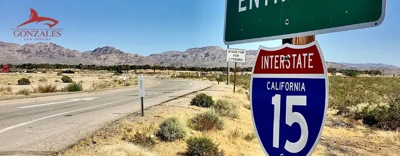
The thing is, I-15 stretches over 1,400 miles from the Canadian border to San Diego, but the California section through the Mojave Desert between Barstow and the Nevada state line? That’s where the real danger concentrates. You’re looking at long, hypnotic stretches where driver fatigue becomes a silent killer. Highway 2, officially known as the Angeles Crest Highway in its most dangerous section, winds through the San Gabriel Mountains with steep drops, tight curves, and conditions that change from dry pavement to ice within a few miles of elevation gain.
Fatality statistics tell the story. According to Caltrans crash data, these routes see disproportionately high fatal accident rates compared to their traffic volume. Not because the roads themselves are inherently flawed (though maintenance is always an issue), but because of how humans interact with these environments.
Accident Hotspots and Safety Concerns
Here’s where it gets interesting.
Big rig traffic on I-15 creates massive hazards. The highway serves as a critical commercial corridor between Southern California and Las Vegas, meaning you’ve got fully loaded semis traveling at high speeds through desert conditions where tire blowouts happen frequently. When a big rig loses control at 70+ mph? The physics aren’t forgiving.
The Cajon Pass section of I-15 deserves special mention. Southbound I-15, from the Cajon Summit, has a steep vertical descent of about 1160 feet over the first 5 miles with a continued lesser descent for about 12 more miles. The reported grade for the southbound descent is 6% over 4 miles. Four-wheelers underestimate how quickly their brakes can overheat. People die on this stretch because they don’t respect what gravity does to a vehicle’s momentum.
Emergency response times present another layer of danger entirely, and this is something people don’t think about until they’re sitting in a damaged vehicle watching their phone search for signal. Survival rates in serious accidents drop dramatically when emergency medical services are delayed, and on remote I-15 and Highway 2 stretches? Response times can be significant due to the rural nature of these areas.
Driver fatigue compounds everything else. Long drives through unchanging scenery create highway hypnosis. Your brain literally stops processing visual information the same way.
Navigating Desert and Mountain Terrains Safely
The Mojave isn’t just hot and empty (though it’s definitely both those things). Desert driving presents hazards most people never consider until they’re facing them. Crosswinds hit your vehicle without warning. Dust storms reduce visibility to zero in seconds. The temperature differential between your air-conditioned car and the outside environment can reach 50+ degrees, which matters tremendously if you break down.
Mountain driving on Highway 2 requires completely different skills and awareness. The San Gabriel Mountains don’t mess around. You’ve got hairpin turns with no guardrails, thousand-foot drops, and road surfaces that transition from perfect asphalt to gravel washout areas where winter storms have eaten the pavement. Caltrans posts mountain pass speed limits for legitimate safety reasons, not to annoy you, but people ignore them constantly and then act surprised when physics takes over.
Here’s what happens on those winding roads: people who live in flat areas don’t understand how to brake properly on sustained downhill grades, they don’t know how to maintain speed through curves, and they panic when they meet opposing traffic on narrow sections. Experienced drivers see this behavior daily and dread it.
Steep drops concentrate your mind wonderfully (in a bad way). One moment of inattention, one overcorrection, and you’re leaving the roadway in a tumbling disaster. The accident reports I’ve seen from Highway 2 incidents often involve vehicles that rolled multiple times down mountainsides. Not everyone walks away from that.
DUI and Distraction: Primary Concerns
Look, I’m going to sound slightly annoyed here, but it’s not directed at you personally. The amount of misinformation people carry about “safe” drinking and driving is staggering. DUI dangers on I-15 spike dramatically on weekend evenings when people drive between Southern California and Las Vegas. The National Institute on Alcohol Abuse and Alcoholism provides clear data on how alcohol impairs driving ability, yet people still convince themselves they’re “fine to drive” after a night in Vegas.
California has zero tolerance for excuses. Blood alcohol content of 0.08% or more means DUI charges, period. And honestly? Your judgment is impaired well before you hit that legal limit, especially when you’re driving through challenging terrain in darkness.
Distracted driving might actually kill more people than DUI on these routes (the statistics compete annually). Desert driving feels safe because you can see forever and the road seems empty. So people check phones. Adjust navigation. Mess with music. Look away for three seconds at 75 mph and you’ve traveled the length of a football field without your eyes on the road.
Speeding issues on long highways seem almost inevitable given the environment. When you’ve been driving for an hour seeing nothing but desert scrub and the occasional Joshua tree, your perception of speed changes. 90 mph starts feeling like 60. Until you need to brake suddenly, or a crosswind hits, or a tire fails, and then you remember why speed limits exist.
Emergency Response and Preparedness
The rural nature of both I-15 and Highway 2 creates serious problems when accidents occur, and I’ve got to emphasize this because people don’t prepare for the reality of remote travel. Cell phone coverage? Spotty at best, completely absent in many sections. Emergency services stretched thin across vast territories. The American Red Cross recommends specific preparedness measures for rural travel, but most people ignore them because “it’s just a drive.”
Long EMS response times mean you might be the first responder to your own emergency or someone else’s accident scene. Do you know basic first aid? Do you carry water, blankets, a first aid kit? Most people don’t. They assume help is always minutes away like it is in cities. Out here? You’re on your own for a while.
Here’s what you absolutely need: Water (at least a gallon per person), high-energy food, blankets, flashlight, first aid supplies, jumper cables, basic tools, phone charger. Sounds excessive until you’re broken down in 110-degree heat watching cars pass by because they’re afraid to stop. Or you’re injured at night on a mountain road where temperatures drop to freezing and the next vehicle might not come for an hour.
Weather and Environmental Challenges
Weather changes everything out here.
Inclement weather driving hazards on I-15 include dust storms (locals call them haboobs, which sounds funny until you’re in one), flash floods that cross the highway with zero warning, and winter ice storms that hit the Cajon Pass and higher elevation sections. The National Weather Service issues warnings, but by the time you’re driving into dangerous conditions, your options are limited.
Highway 2 faces even more dramatic weather challenges because of elevation changes. You can start your drive in 80-degree sunshine in La Cañada Flintridge and 30 minutes later be in a snowstorm at 7,000 feet. The seasonal driving challenges compound during winter months when the highway frequently closes due to snow and ice, but people try to “beat the closure” and end up stranded or worse.
Summer brings its own problems (fire season turns Highway 2 into a smoke-choked nightmare regularly, and actual wildfires close the road entirely). The environmental challenges aren’t just inconveniences, they’re legitimate safety threats that require you to check conditions before you leave and have backup plans.
Adverse weather conditions reduce your margin for error to basically nothing. That curve you could take at 45 mph in dry conditions? Maybe 25 mph in rain. Maybe impassable in snow. People who don’t adjust their driving to conditions cause accidents, full stop.
Legal Considerations and Road Safety Initiatives
California’s legal framework around highway safety continues evolving, with recent initiatives focused on reducing the fatality rates that plague both I-15 and Highway 2. The Centers for Disease Control and Prevention tracks transportation-related injuries as a major public health issue, which has led to increased federal funding for safety improvements on high-risk corridors.
Recent safety initiatives include enhanced signage on dangerous curves, rumble strips to combat drowsy driving, wildlife crossing warnings in areas where animal strikes occur frequently (and yes, hitting a deer at highway speed can absolutely kill you), and increased Highway Patrol presence during high-traffic periods. Legislation aimed at reducing fatalities often focuses on distracted driving laws, DUI checkpoints, and commercial vehicle safety inspections.
But here’s the reality: all the laws and safety improvements in the world can’t protect you if you’re not driving defensively and staying aware of conditions. Legal compliance matters, yes. But personal responsibility for your safety and the safety of others matters more.
The highway safety authority recommendations from NHTSA and state agencies are actually pretty straightforward if you strip away the bureaucratic language. Maintain your vehicle. Don’t drive impaired. Adjust speed to conditions. Stay alert. Wear your seatbelt. Simple stuff that somehow people still fail to do consistently.
Transportation safety management continues improving on these routes. Caltrans regularly updates road conditions, performs maintenance, and responds to hazards. They’re not perfect (no agency is), but the resources are available if you bother to check them before you drive.
Frequently Asked Questions
What is the deadliest highway in the US?
Depends on how you measure it. Interstate 95 has the highest total fatalities with approximately 3,000 wrongful deaths annually. But for fatality rate per mile? Highway 2 in Montana consistently ranks as one of the worst. I-15 through California and Nevada isn’t far behind though.
Is driving on I-15 safe?
Not really – at least not compared to most interstates. The stretch through the Mojave Desert sees way more fatal accidents than average. Long straight roads make people zone out, there’s heavy truck traffic, and help can be 30+ miles away if something goes wrong. You’ll be fine if you stay alert and don’t speed, but it demands respect.
How can I prepare for a road trip on Highway 2?
Full tank before you hit remote sections. Water, snacks, phone charger, basic first aid kit. Check weather conditions beforehand because mountain passes can turn nasty fast. Tell someone your route and when you expect to arrive. Sounds paranoid, but cell service disappears for long stretches and you won’t see another car for miles sometimes.
What are the most dangerous sections of I-15?
The Nevada-California border area through Baker and the stretch near Barstow see the most accidents. Also watch out between Victorville and Hesperia – it’s a major truck corridor with constant lane changes and aggressive drivers mixing with weekend Vegas traffic. People treat it like a race track.
How do weather conditions affect Highway 2 travel?
Winter closes mountain passes without warning. Summer heat kills engines and tires in the desert sections. Sudden thunderstorms create flash flooding. Honestly, Highway 2 throws everything at you depending on the season. The San Gabriel Mountains section gets sketchy with fog and ice November through March. Check Caltrans road conditions before you go.
What are common causes of accidents on I-15?
Speeding and driver fatigue, hands down. People gun it across the desert thinking empty road equals safe road. Wrong. Also see tons of DUI crashes, especially Sunday mornings with people driving back from Vegas. Distracted driving is huge too – you glance at your phone for five seconds at 80 mph and you’ve traveled the length of a football field blind.
How can I stay safe while driving through desert terrains?
Stay hydrated yourself, not just your car. Heat exhaustion messes with your judgment before you realize it. Keep your speed reasonable even when the road looks clear for miles. Watch for sudden wind gusts that’ll push your car around. And seriously, don’t rely on your phone for navigation – download offline maps because you’ll lose signal.
What emergency response resources are available on these highways?
Limited, which is the problem. California Highway Patrol patrols regularly, and there are call boxes on I-15. But actual EMS response? Response times can be significant in rural areas. Better to avoid needing them.
Are there any recent improvements on I-15 and Highway 2?
I-15 got some widening projects near Barstow and better signage in accident-prone areas. They added rumble strips on shoulder sections too. Highway 2? Not much – budget constraints mean it’s mostly just patching and basic maintenance. The infrastructure money from the federal highway bill is slowly trickling in, but major safety overhauls are still years away.
Gonzales Law Offices: Your Highway Accident Law Firm
Look, traveling these highways shouldn’t feel like taking your life into your hands. We represent people impacted by I-15 and Highway 2 crashes, and the patterns are clear – dangerous conditions, negligent drivers, inadequate warnings. You already know something needs to change. What matters now is protecting your rights and securing the compensation you’re entitled to after an accident on these routes.
We handle cases involving everything from weather-related pileups to construction zone collisions. And we don’t back down from insurance companies trying to minimize your claim. Contact our firm today and let’s discuss what happened to you.
San Bernardino Car Accident Resources: