|
|
Last Modified on Jan 23, 2026
You’re driving through San Bernardino, gripping the wheel a little tighter at certain intersections. Maybe you’ve already had a close call, or worse, you’ve been in a car accident on a road you drive every day. When you start asking about the most dangerous roads and intersections in San Bernardino, it’s usually because you want to protect yourself or understand why something happened to you or someone you love.
Here’s the thing: some streets in this city have earned their reputation the hard way, through years of collision data and too many families affected. The team at Gonzales Law Offices has seen it firsthand. And knowing which areas demand extra caution can genuinely make a difference.
Let’s look at where the data points to real danger.
Key Takeaways
- Interstate 15, particularly through Cajon Pass, consistently ranks among America’s deadliest highways due to steep grades, high speeds, and heavy commercial truck traffic
- The intersection of Sterling Avenue and 5th Street represents one of San Bernardino’s most dangerous junctions, with complex traffic patterns and frequent collisions
- State Route 138 earned the nickname “Blood Alley” for good reason – sharp curves, narrow lanes, and steep terrain create deadly conditions
- Most accident-prone areas share common factors: poor lighting, confusing lane configurations, high-speed differentials, and heavy traffic volume
- Understanding where accidents concentrate helps drivers take extra precautions in these high-risk zones
Understanding San Bernardino’s High-Risk Traffic Areas
I’ve explained this to countless people over the years, and here’s the truth: San Bernardino County has some seriously dangerous roads. Not just “be careful” dangerous. Actually dangerous.
The accident rates here aren’t random. There’s a pattern. High-speed desert highways meeting congested urban streets. Add in major commercial corridors (we’re talking massive truck traffic), challenging terrain, and rapid population growth, and you’ve got a recipe for collisions.
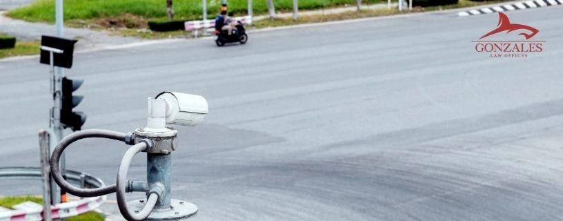
Caltrans data shows that certain corridors see disproportionately high crash rates. The thing is, most drivers don’t realize they’re entering a high-risk area until it’s too late. These aren’t always marked with warning signs or reduced speed limits. Sometimes you’re just driving along and suddenly you’re in one of the county’s most dangerous stretches.
Speeding plays a huge role. So does distracted driving. But infrastructure matters too – poorly designed intersections, inadequate lighting, confusing lane merges. All of it compounds.
Interstate 15: America’s Deadliest Road
Here’s where it gets serious.
Interstate 15 through San Bernardino County, especially the Cajon Pass section, consistently appears on lists of America’s most dangerous highways. The National Highway Traffic Safety Administration tracks these statistics, and they’re sobering. We’re talking hundreds of fatal crashes over the past decade.
Why so deadly? Multiple factors converge here. First, you’ve got a six percent grade through the Cajon Pass. That might not sound extreme, but for fully loaded commercial trucks traveling at highway speeds, it’s significant. Brake failure happens. Runaway truck ramps exist for a reason (and they get used more often than you’d think).
Second, the speed differential creates hazards. Cars traveling 75-80 mph sharing lanes with trucks grinding uphill at 35 mph. That’s dangerous.
Weather compounds everything – fog, rain, occasional snow, high winds. Visibility drops. Road conditions deteriorate. And people still drive too fast because they’re late or impatient or just not paying attention.
The California Highway Patrol increases enforcement along this corridor, but even with regular patrols, accidents happen daily. Some fatal. Many resulting in serious injuries.
Intersection Hotspots: San Bernardino’s Most Dangerous Junctions
Sterling Avenue and 5th Street. Just mentioning that intersection makes local drivers wince.
The complexity here is real – multiple lanes, heavy traffic from all directions, pedestrians crossing, cyclists trying to navigate through. According to the San Bernardino County Transportation Authority, this intersection consistently ranks among the highest for collision frequency in the entire county.
Poor sight lines don’t help. Neither does the lighting (though recent improvements have helped somewhat). Add drivers making illegal turns or running red lights, and you’ve got constant close calls.
Other dangerous intersections include:
- Highland Avenue and 5th Street
- Waterman Avenue and 40th Street
- Del Rosa Avenue and Mill Street
- Baseline Street and Tippecanoe Avenue
Each has unique hazards. Some have confusing lane configurations. Others suffer from inadequate signal timing. A few have all these problems combined.
The Risks of Driving State Route 138: Blood Alley Explained
“Blood Alley.”
That’s what locals call State Route 138, and the nickname isn’t exaggeration or drama. This two-lane highway connecting the high desert to Interstate 5 has claimed countless lives over the decades, and the California Office of Traffic Safety has designated it a priority corridor for safety improvements.
Now here’s where it gets tricky. The road itself is scenic – winding through mountainous terrain with elevation changes and sweeping views. But those same characteristics make it deadly. Sharp S-curves that tighten unexpectedly. Steep drop-offs with minimal guardrails. Narrow lanes that leave zero margin for error. And here’s the thing that really gets me: inadequate passing zones combined with impatient drivers create a constant stream of dangerous passing attempts.
Motorcyclists particularly love this road (the curves, the scenery, the challenge of it), but they’re also disproportionately represented in the fatality statistics. Speed is a factor in most motorcycle crashes here. So is driver inexperience with mountain roads. People from flat areas don’t always understand how to properly navigate steep grades and tight curves.
The California Highway Patrol maintains regular enforcement presence, but you can’t put a patrol car on every curve. Driver responsibility matters here more than almost anywhere else in the county.
Interstate 10: A Major Player in San Bernardino Traffic Accidents
Interstate 10 cuts straight through San Bernardino, and if you think being a major east-west corridor makes it safer, think again. High traffic volume, aggressive driving, and congestion-related incidents make this another accident hotspot.
This freeway sees everything: rear-end collisions during rush hour, sideswipes from improper lane changes, rollover accidents from excessive speed, multi-vehicle pileups when traffic suddenly slows. According to research from the Institute of Transportation Studies, congestion actually increases certain types of accidents even though speeds are lower.
Reckless driving is prevalent here. I’m talking about drivers weaving through traffic, tailgating, cutting people off. The usual freeway nonsense, but with higher stakes because of traffic density.
And then you’ve got distracted driving – people on their phones, eating, doing their makeup (I’m not making this up, I’ve heard every variation). At freeway speeds, even a momentary distraction can trigger a chain-reaction crash involving multiple vehicles.
Prevention strategies exist. Following distance matters. Staying alert. Avoiding aggressive driving behaviors. But honestly, even defensive drivers get caught up in accidents caused by someone else’s poor decisions. The Federal Highway Administration continues studying ways to improve safety on high-volume corridors like this one, but infrastructure improvements take years to implement and fund.
Sterling Avenue to 5th Street: San Bernardino’s Dangerous Intersection
Yeah, we’re coming back to this intersection because it deserves special attention.
The complexity here goes beyond just traffic volume. You’ve got commercial zones generating truck traffic. Residential areas contributing local drivers. Through traffic trying to get across town quickly. All converging at one point.
Pedestrian safety is a major concern. People crossing mid-block because the intersection feels too dangerous or takes too long. Jaywalking incidents. Near-misses that don’t get reported but happen constantly.
The intersection design itself contributes to problems – some turn lanes are too short, causing backups that block through traffic. Signal timing doesn’t always account for actual traffic patterns (especially during peak hours when volume exceeds what the intersection was designed to handle).
Urban planning decisions made decades ago didn’t anticipate current traffic levels. Retrofitting intersections is expensive and disruptive, so improvements happen slowly if at all. Meanwhile, accidents keep happening.
Tips for Driving Safely on San Bernardino’s High-Risk Roads
Here’s what happens when you understand where the dangers are: you can actually do something about it.
First, adjust your driving based on location. Approaching that dangerous intersection on Sterling? Leave extra following distance. Give yourself time to react. Don’t rush the yellow light.
On Interstate 15 through Cajon Pass? Check your brakes before descending. Use lower gears to help slow your vehicle. Don’t ride alongside big trucks (give them space because if something goes wrong, you don’t want to be next to them).
State Route 138 demands respect. If you’re not comfortable with mountain driving, consider alternate routes. If you must drive it, slow down before curves (not during them). Never attempt passing unless you have clear visibility for at least a quarter mile. And for crying out loud, put your phone away completely.
Here are practical safety measures:
- Maintain your vehicle properly (brakes, tires, lights)
- Increase following distance in high-risk areas
- Eliminate distractions completely
- Drive at speeds appropriate for conditions, not just the posted limit
- Plan routes to avoid known danger zones during peak times
But beyond individual responsibility, community involvement matters too. Report dangerous conditions to local authorities. Support infrastructure improvement projects. Attend city planning meetings when transportation issues are discussed.
The California Highway Patrol offers defensive driving courses that specifically address regional hazards. Taking one isn’t admitting you’re a bad driver – it’s acknowledging that local conditions require specific knowledge and skills.
Look, I can’t stress this enough: awareness alone reduces risk significantly. When you know you’re entering a high-accident area, your attention sharpens. You drive more defensively. You make better decisions. That knowledge might literally save your life or someone else’s.
Frequently Asked Questions
What are the most dangerous streets in San Bernardino?
You’re looking at Interstate 15, State Route 138 (locals call it Blood Alley for a reason), and Interstate 10. Sterling Avenue gets nasty where it hits 5th Street – that intersection’s a mess. Del Rosa Avenue and Arrowhead Avenue rack up their share of crashes too, especially during rush hour.
How often do fatal crashes happen on Interstate 15?
Way too often. According to NHTSA data, I-15 consistently ranks as one of America’s deadliest highways. The Cajon Pass section alone sees multiple fatalities yearly, especially involving big rigs and speeding-related incidents. Weather and steep grades don’t help.
How can I avoid the risks associated with State Route 138?
Slow down through those S-turns – seriously, the speed limit’s posted low for a reason. Drive it during daylight if you can, because the lighting’s terrible at night. Keep way more following distance than normal, and if someone’s riding your bumper, let them pass at a turnout.
What role do local government agencies play in road safety?
SBCTA handles transportation planning and infrastructure improvements. California Highway Patrol does enforcement. Caltrans maintains state highways and collects crash data. They all coordinate on big projects, but honestly, changes happen slowly because funding’s always tight.
How can drivers improve their safety on high-risk roads?
Ditch your phone, leave earlier so you’re not rushing, and assume everyone else will do something stupid. Check your blind spots twice on I-15. At intersections, wait that extra second even when your light turns green.
Are there any new safety measures planned for San Bernardino’s roads?
Some improvements are in the works through SBCTA projects, including intersection upgrades and better signage. But these things take years from planning to completion, so don’t hold your breath for overnight changes.
What are the statistics for drunk driving and speeding-related accidents in the area?
Depends on which year you’re asking about, but it’s consistently bad. California OTS tracks this stuff – San Bernardino County regularly shows higher than average DUI rates compared to the state. Speeding factors into about a third of fatal crashes on highways like I-15 and I-10. Not great numbers.
Gonzales Law Offices: Your San Bernardino Traffic Accident Law Firm
Knowing which intersections are dangerous is helpful. But if you’ve already been injured on one of these roads, that information doesn’t fix your medical bills or totaled car. And honestly? Insurance companies don’t care how notorious that intersection is – they’ll still lowball you.
We’ve handled these cases before. The moment after an accident matters. Getting proper documentation of the scene, securing witness statements, establishing fault while evidence is fresh. Short answer: don’t wait.
Contact our firm today if you’ve been hurt in a San Bernardino traffic accident. We can help you do something about it.
San Bernardino Car Accident Resources: